It's time for me to go home. I have enjoyed my time in Washington. It has been fun to see Seattle, Whidbey Island, Canada and Ireland. People have been friendly and I'm glad I was sent here.
I will have fond memories of my stay here!
Sunday, May 17, 2009
Saturday, May 16, 2009
Interesting facts about Washington
Washington is the 42nd state in the USA; it became a state on November 11, 1889.
State Abbreviation - WA
State Capital - Olympia
Largest City - Seattle
Area - 71,303 square miles, Washington is the 18th biggest state in the US
Population - 5,894,121 (as of 2000) Washington is the 15th most populous state in the US
Major Industries - farming (fruit, berries, nuts, cattle, wheat), lumber, tourism, hydroelectric power, computer software, aircraft, aluminum refining
Major Rivers - Columbia River, Snake River, Yakima River
Highest Point - Mt. Rainier - 14,410 feet above sea level
Bordering States - Idaho, Oregon
Bordering Country - Canada
Bordering Bodies of Water - Pacific Ocean, Puget Sound
Origin of the Name Washington - George Washington, the first president of the US.
State Nickname - The Evergreen State
State Motto - "Alki" (By and By)
State Song - Washington, My Home
State Bird - American Goldfinch
State Flower - Coast rhododendron
State Tree - Western hemlock
State Fruit - Apple
State Fish - Steelhead trout
State Marine Mammal - Orca
State Gem - Petrified wood
State Dance - Square dance
Friday, May 15, 2009
Back to Seattle!
Today Dena took me back to Seattle!
I got to ride another ferry to Bainbridge Island! Bainbridge Island is located within the Central Puget Sound Basin, east of the Kitsap Peninsula and west of the City of Seattle. The island is approximately five miles wide and ten miles long, encompassing nearly 17,778 acres, or 28 square miles, and is one of the larger islands in Puget Sound.
It was cool to see Seattle from the water!
From the ferry I could see large cranes that lift shipping containers off barges. They kind of look like something straight out of Star Wars!
Thursday, May 14, 2009
A tree farmer?
Today I went to see a lumber mill!
There were piles and piles of logs and pallets and pallets of lumber! It was so cool!
With ideal climate, soil, and growing conditions, trees in Washington grow fast. There’s a reason that it’s called the “Evergreen State”. Washington is home to 23 million acres of forestland of which 16.2 million acres are classified as commercial forest. Only 18% is owned specifically by the forest products industry and account for 80% of Washington’s annual harvest – 3 billion board feet.
Washington State is the largest exporter of forest products and the largest softwood lumber producer in the US. Despite Washington’s history as a producer of primary wood products, the secondary forest products market, like paper and pulp, is also flourishing. Many Washington colleges have programs dedicated specifically to the Forest Products industry.
Click here if you would like to see a video of how this sawmill works.
Click here to find out how they manage their trees.
For more information: www.choosewashington.com
Wednesday, May 13, 2009
Conway, Washington
Today, Dena took me to Conway. That's right, there is a Conway, Washington, just a few miles from Mount Vernon. I went to the feed store while I was there.
It's a very small town. Population in the 2000 census was only 84. Like Grovespring, children attend school at Conway Elementary School from Kindergarten through the 8th grade, and then go to high school somewhere else. Parents choose a high school from the three closest: Stanwood, Mount Vernon or LaConner. Since only Mount Vernon provides a bus to the Conway area, most of the students go there.
Monday, May 11, 2009
Did you know?
There is farmland in the Puget Sound?
Part of Washington agriculture is aquaculture. Farmers grow mussles, clams and oysters throughout Puget Sound. In fact, one of the largest mussel growers in the world is on Whidbey Island.
Penn Cove Mussels, Inc. was established by the Jefferds family in June of 1975 in Coupeville, Washington. Penn Cove was chosen for the mussel farm due to the unique hydrological and geographic features of the cove which make it the most prolific mussel growing area in the state. The geography of Penn Cove makes it a nutrient trap for the outflows of the Skagit and Stillaguamish River systems. The fresh water and nutrients combined with sun shine provided by the rain shadow effect of the Olympic Mountains tends to turn Penn Cove in to a bay of plankton soup for the mussels.
Mussels are very efficient filter feeders, with adults able to filter about 15 gallons of water per day; They can filter up to 60% of the plankton out of the water which they take in.
The mussel farm in Penn Cove is the home of the oldest and largest commercial mussel farm in the United States and Penn Cove Mussels have won top honors and international tasting competitions.
For more information: www.penncoveshellfish.com
Thursday, May 7, 2009
Going through photos...
Wednesday, May 6, 2009
The flight home
Tuesday, May 5, 2009
The Last Day Around Dublin
Today was our last day in Dublin, so we decided to walk round the city a while. Our first stop was Grafton Street.
Grafton Street is one of the two principal shopping streets in Dublin city center, the other being Henry Street. It runs from St. Stephen's Green in the south to College Green in the north. The street was named after Henry FitzRoy, 1st Duke of Grafton, who owned land in the area. The street was developed from a then existing country lane by the Dawson family in 1708, after whom the parallel Dawson Street is named.
Since the 1980s, the street has been mostly pedestrianised, with the exception of the short stretch running between Nassau Street and College Green. This short stretch contains two notable Dublin landmarks, the eighteenth century Trinity College Provost's House, home to the head of the college, and the late twentieth century statue of Molly Malone, which has become a popular Dublin meeting place.
The Molly Malone statue was designed by Jeanne Rynhart and was erected to celebrate the city's first millennium in 1987. 'Molly Malone' is a popular song, set in Dublin, Ireland, which has become the unofficial anthem of Dublin City. It has also in Ireland acquired the status of an Irish anthem.
The song tells the tale of a beautiful fishmonger who plied her trade on the streets of Dublin, but who died young, of a fever. Recently a legend has grown up that there was a historical Molly, who lived in the 17th century. However, there is no evidence that the song is based on a real woman, of the 17th century or at any other time.
The song lyrics are as follows:
In Dublin's fair city,
where the girls are so pretty,
I first set my eyes on sweet Molly Malone,
As she wheeled her wheel-barrow,
Through streets broad and narrow,
Crying, "Cockles and mussels, alive, alive, oh!"
"Alive, alive, oh,
Alive, alive, oh",
Crying "Cockles and mussels, alive, alive, oh".
She was a fishmonger,
And sure 'twas no wonder,
For so were her father and mother before,
And they each wheeled their barrow,
Through streets broad and narrow,
Crying, "Cockles and mussels, alive, alive, oh!"
(chorus)
She died of a fever,
And no one could save her,
And that was the end of sweet Molly Malone.
Now her ghost wheels her barrow,
Through streets broad and narrow,
Crying, "Cockles and mussels, alive, alive, oh!"
Some other sights we saw were The Spire of Dublin. The Spire, officially titled the Monument of Light is a large, stainless steel, pin-like monument 390 ft in height, located on the site of the former Nelson's Pillar on O'Connell Street in Dublin.
A statue of James Joyce, the world-famous Irish writer, walking with a cane in his hand.
O'Connell Street and alot of other interesting things.
Tomorrow we fly home. I have had a great time visitng Ireland and I will be sad to leave.
Grafton Street is one of the two principal shopping streets in Dublin city center, the other being Henry Street. It runs from St. Stephen's Green in the south to College Green in the north. The street was named after Henry FitzRoy, 1st Duke of Grafton, who owned land in the area. The street was developed from a then existing country lane by the Dawson family in 1708, after whom the parallel Dawson Street is named.
Since the 1980s, the street has been mostly pedestrianised, with the exception of the short stretch running between Nassau Street and College Green. This short stretch contains two notable Dublin landmarks, the eighteenth century Trinity College Provost's House, home to the head of the college, and the late twentieth century statue of Molly Malone, which has become a popular Dublin meeting place.
The Molly Malone statue was designed by Jeanne Rynhart and was erected to celebrate the city's first millennium in 1987. 'Molly Malone' is a popular song, set in Dublin, Ireland, which has become the unofficial anthem of Dublin City. It has also in Ireland acquired the status of an Irish anthem.
The song tells the tale of a beautiful fishmonger who plied her trade on the streets of Dublin, but who died young, of a fever. Recently a legend has grown up that there was a historical Molly, who lived in the 17th century. However, there is no evidence that the song is based on a real woman, of the 17th century or at any other time.
The song lyrics are as follows:
In Dublin's fair city,
where the girls are so pretty,
I first set my eyes on sweet Molly Malone,
As she wheeled her wheel-barrow,
Through streets broad and narrow,
Crying, "Cockles and mussels, alive, alive, oh!"
"Alive, alive, oh,
Alive, alive, oh",
Crying "Cockles and mussels, alive, alive, oh".
She was a fishmonger,
And sure 'twas no wonder,
For so were her father and mother before,
And they each wheeled their barrow,
Through streets broad and narrow,
Crying, "Cockles and mussels, alive, alive, oh!"
(chorus)
She died of a fever,
And no one could save her,
And that was the end of sweet Molly Malone.
Now her ghost wheels her barrow,
Through streets broad and narrow,
Crying, "Cockles and mussels, alive, alive, oh!"
Some other sights we saw were The Spire of Dublin. The Spire, officially titled the Monument of Light is a large, stainless steel, pin-like monument 390 ft in height, located on the site of the former Nelson's Pillar on O'Connell Street in Dublin.
A statue of James Joyce, the world-famous Irish writer, walking with a cane in his hand.
O'Connell Street and alot of other interesting things.
Tomorrow we fly home. I have had a great time visitng Ireland and I will be sad to leave.
Monday, May 4, 2009
A park in the City
As we were walking around Dublin today we came upon St. Stephen's Green.
St Stephen's Green is an inner-city public park within the city center. The park is rectangular, surrounded by streets that once formed major traffic arteries through Dublin city center.
Until 1663 St Stephen’s Green was a marshy common on the edge of Dublin, used for grazing. In that year Dublin Corporation, seeing an opportunity to raise much needed revenue, decided to enclose the center of the common and to sell land around the perimeter for building. The park was enclosed with a wall in 1664. The houses built around the Green were rapidly replaced by new buildings in the Georgian style and by the end of the eighteenth century the Green was a place of resort for the better-off of the city. Much of the present-day landscape of the square comprises modern buildings, some in a replica Georgian style, and relatively little survives from the 18th and 19th centuries.
While the central park of St Stephen's Green is one of three ancient commons in the city, its current layout owes much to the restorations of the 1800s.
The grounds are roughly rectangular and are centred on a formal garden. One of the more unusual aspects of the park lies on the north west corner of this central area - a garden for the blind with scented plants, which can withstand handling, and are labelled in Braille.
Further north again is a large lake. Home to ducks and other water fowl, the lake is fed by an artificial water fall, spanned by O'Connell bridge, and fronted by an ornamental gazebo. The lakes in the park are fed from the Grand Canal at Portbello.
It was really nice to escape the hustle and bustle of the city and enjoy some quiet time watching the ducks and seagulls in the pond and enjoying the fountains.
St Stephen's Green is an inner-city public park within the city center. The park is rectangular, surrounded by streets that once formed major traffic arteries through Dublin city center.
Until 1663 St Stephen’s Green was a marshy common on the edge of Dublin, used for grazing. In that year Dublin Corporation, seeing an opportunity to raise much needed revenue, decided to enclose the center of the common and to sell land around the perimeter for building. The park was enclosed with a wall in 1664. The houses built around the Green were rapidly replaced by new buildings in the Georgian style and by the end of the eighteenth century the Green was a place of resort for the better-off of the city. Much of the present-day landscape of the square comprises modern buildings, some in a replica Georgian style, and relatively little survives from the 18th and 19th centuries.
While the central park of St Stephen's Green is one of three ancient commons in the city, its current layout owes much to the restorations of the 1800s.
The grounds are roughly rectangular and are centred on a formal garden. One of the more unusual aspects of the park lies on the north west corner of this central area - a garden for the blind with scented plants, which can withstand handling, and are labelled in Braille.
Further north again is a large lake. Home to ducks and other water fowl, the lake is fed by an artificial water fall, spanned by O'Connell bridge, and fronted by an ornamental gazebo. The lakes in the park are fed from the Grand Canal at Portbello.
It was really nice to escape the hustle and bustle of the city and enjoy some quiet time watching the ducks and seagulls in the pond and enjoying the fountains.
Sunday, May 3, 2009
Skerries Mills and the Beach
Today we caught the DART north to see Skerries Mills.
The DART is a rapid transit system that runs up and down the coastline of Dublin Bay.
Skerries Mills is located north of Dublin in the seaside town of Skerries. The mills in Skerries were used for grinding corn: wheat, oats and barley - wind power complementing water power, particularly in times of drought. At the dissolution of the monasteries under Henry VIII in 1538, the Canons Regular of St Augustin of Holmpatrick owned c.1000 acres of land in the vicinity of present-day Skerries and counted a watermill among their possessions.
The second windmill, known as The Great Windmill of Skerries was probably built towards the end of the 18th century when the former had fallen into disrepair. Stormy weather in the mid- 1840's badly damaged this mill but it was rebuilt in a five-sail version and became a popular symbol in holiday posters for Skerries.
There are three sets of grinding stones in the Skerries watermill, powered by an overshot waterwheel. A large mill-pond controlled by a series of sluice-gates feeds the water to the mill. The four floors or lofts are served by two bag-hoists; winnowers and a blower are located above the stone floor and below the hoppers in the top loft.
The Skerries windmills are both tower-mills, where the cap or top of the mill is turned to the wind. The older of the two mills is perched on the site of a prehistoric fort, the highest point in the town. The cap is thatched and turned into the wind from inside by a hand lever.
The Great Windmill of Skerries commands magnificent views of the coast and surrounding countryside. This mill contains two sets of grinding stones and the cap is pulled into the wind by a tail-pole.
The mills enclose a four-acre mill field where the annual crop is grown.
Our tour guide deomonstrated how the waterwheel worked by releasing the water. The water turned the wheel and the wheel turned the stones to grind the wheat into flour. It was LOUD. The windmills work similarly, but instead of water, the wind turns the sails.
After our tour of the mills, we walked down to the beach.
The tide was way out and we could see Rockbill Lighthouse from the shore. There were seagulls and shorebirds settled in the beach. We were able to collect some shells and sand from the beach too!
The DART is a rapid transit system that runs up and down the coastline of Dublin Bay.
Skerries Mills is located north of Dublin in the seaside town of Skerries. The mills in Skerries were used for grinding corn: wheat, oats and barley - wind power complementing water power, particularly in times of drought. At the dissolution of the monasteries under Henry VIII in 1538, the Canons Regular of St Augustin of Holmpatrick owned c.1000 acres of land in the vicinity of present-day Skerries and counted a watermill among their possessions.
The second windmill, known as The Great Windmill of Skerries was probably built towards the end of the 18th century when the former had fallen into disrepair. Stormy weather in the mid- 1840's badly damaged this mill but it was rebuilt in a five-sail version and became a popular symbol in holiday posters for Skerries.
There are three sets of grinding stones in the Skerries watermill, powered by an overshot waterwheel. A large mill-pond controlled by a series of sluice-gates feeds the water to the mill. The four floors or lofts are served by two bag-hoists; winnowers and a blower are located above the stone floor and below the hoppers in the top loft.
The Skerries windmills are both tower-mills, where the cap or top of the mill is turned to the wind. The older of the two mills is perched on the site of a prehistoric fort, the highest point in the town. The cap is thatched and turned into the wind from inside by a hand lever.
The Great Windmill of Skerries commands magnificent views of the coast and surrounding countryside. This mill contains two sets of grinding stones and the cap is pulled into the wind by a tail-pole.
The mills enclose a four-acre mill field where the annual crop is grown.
Our tour guide deomonstrated how the waterwheel worked by releasing the water. The water turned the wheel and the wheel turned the stones to grind the wheat into flour. It was LOUD. The windmills work similarly, but instead of water, the wind turns the sails.
After our tour of the mills, we walked down to the beach.
The tide was way out and we could see Rockbill Lighthouse from the shore. There were seagulls and shorebirds settled in the beach. We were able to collect some shells and sand from the beach too!
Saturday, May 2, 2009
A Cathedral and a Church
Today we went to Saint Patrick's Cathedral and Christ Church.
Saint Patrick on his journey through Ireland is said to have passed through Dublin. In a well close to where the cathedral now stands, he is reputed to have baptised converts from paganism to Christianity. To commemorate his visit, a small wooden church was built on this site, one of the four Celtic parish churches in Dublin.
In 1191, under John Comyn, the first Anglo-Norman archbishop of Dublin, Saint Patrick's was raised to the status of a cathedral and the present building, the largest church in the country, was erected between 1200 and 1270. Over the centuries as the elements, religious reformation and persecution took their toll, the cathedral fell into serious disrepair, despite many attempts to restore it. Eventually between 1860 and 1900 a full-scale restoration based on the original design, was carried out by the Guinness family.
The gothic style cathedral has high vaulted ceilings and many colorful stained glass windows. Someone was playing the organ and it was neat to read all the monuments.
After Saint Patrick's Cathedral we walked over to Christ Church.
A wooden church was built at this site in 1038. In 1171 the original simple foundation was extended into a cruciform and rebuilt in stone for the English crown. The present structure dates mainly from the 1870s, when a major restoration took place, making the cathedral look more Victorian than Anglo-Norman.
It was in this period that one of Dublin's most charming structures was added: a Bridge of Sighs-like affair that connects the cathedral to the old Synod Hall, which now holds the Viking multi-media exhibition "Dublinia."
It's a beautiful church and also contains the largest cathedral crypt in Britain or Ireland, constructed in 1172-1173. The crypt had many artifacts including a mummified cat and rat found trapped in the organ.
Saint Patrick on his journey through Ireland is said to have passed through Dublin. In a well close to where the cathedral now stands, he is reputed to have baptised converts from paganism to Christianity. To commemorate his visit, a small wooden church was built on this site, one of the four Celtic parish churches in Dublin.
In 1191, under John Comyn, the first Anglo-Norman archbishop of Dublin, Saint Patrick's was raised to the status of a cathedral and the present building, the largest church in the country, was erected between 1200 and 1270. Over the centuries as the elements, religious reformation and persecution took their toll, the cathedral fell into serious disrepair, despite many attempts to restore it. Eventually between 1860 and 1900 a full-scale restoration based on the original design, was carried out by the Guinness family.
The gothic style cathedral has high vaulted ceilings and many colorful stained glass windows. Someone was playing the organ and it was neat to read all the monuments.
After Saint Patrick's Cathedral we walked over to Christ Church.
A wooden church was built at this site in 1038. In 1171 the original simple foundation was extended into a cruciform and rebuilt in stone for the English crown. The present structure dates mainly from the 1870s, when a major restoration took place, making the cathedral look more Victorian than Anglo-Norman.
It was in this period that one of Dublin's most charming structures was added: a Bridge of Sighs-like affair that connects the cathedral to the old Synod Hall, which now holds the Viking multi-media exhibition "Dublinia."
It's a beautiful church and also contains the largest cathedral crypt in Britain or Ireland, constructed in 1172-1173. The crypt had many artifacts including a mummified cat and rat found trapped in the organ.
Friday, May 1, 2009
Did you know?
Saint Patrick's Day is an Irish holiday?
Saint Patrick's Day, sometimes referred to as St. Paddy's Day or simply Paddy's Day, is an annual feast day which celebrates Saint Patrick, one of the patron saints of Ireland, and is generally celebrated on 17th of March.
The day is the national holiday of Ireland: it is a bank holiday in Northern Ireland and a public holiday in the Republic of Ireland. Saint Patrick's Day is celebrated worldwide by those of Irish descent and increasingly by people of other ethnicities as well, notably in Argentina, Australia, New Zealand and North America. Celebrations are generally themed around all things Irish and, by association, the color green.
Green ribbons and shamrocks were worn in celebration of St Patrick's Day as early as the 17th century, even though St. Patrick's Blue was the color traditionally associated with St. Patrick. He is said to have used the shamrock, a three-leaved plant, to explain the Holy Trinity to the pre-Christian Irish, and the wearing and display of shamrocks and shamrock-inspired designs have become a ubiquitous feature of the day. The phrase "the wearing of the green", meaning to wear a shamrock on one's clothing.
Thursday, April 30, 2009
The Library and a Castle
We are staying at the Regency Hotel in Whitehall. Whitehall is on the northern outskirts of Dublin's inner city between Dublin and the airport. Dublin is both the largest city and capital of Ireland. It is located near the midpoint of Ireland's east coast, at the mouth of the River Liffey and at the center of the Dublin Region. Founded as a Viking settlement, the city has been Ireland's primary city for most of the island's history since medieval times. Today, it is ranked 10th in the Global Financial Centres Index and has one of the fastest growing populations of any European capital city.
After a nice continental breakfast, we caught the bus to Dublin. The hotel is conveniently located right next to a bus stop and it only takes 10 minutes to get to the city center. We walked from the bus drop off to the Chester Beatty Library.
The Chester Beatty Library is a public charitable trust established under the will of the late Sir Alfred Chester Beatty, which was granted probate in 1969. The role of the Library is to protect, preserve and make available to the public in the form of exhibitions, popular publications, lectures and other events the heritage enshrined in the collections of the late Chester Beatty.
Next door to the Chest Beatty Library is Dublin Castle. Dublin Castle was first founded as a major defensive complex upon the orders of King John of England in 1204, shortly after the Norman invasion of Ireland in 1169, when it was commanded that a castle be built with strong walls and good ditches for the defense of the city, the administration of justice, and the protection of the King’s treasure. Largely complete by 1230, the castle was of typical Norman courtyard design, with a central square devoid of a keep, bounded on all sides by tall defensive walls and protected at each corner by a circular tower. The building survived until 1673 when it was damaged by fire and demolished shortly afterwards. No trace of medieval buildings remain above ground level today, with the exception of the great Record Tower. It is the sole surviving tower of the original fortification, its battlements an early 19th-century addition.
The castle is a tourist attraction and, following major refurbishment, is also used as a conference center. During Ireland's presidencies of the European Union, including most recently in the first half of 2004, it has been the venue of many meetings of the European Council. The crypt of the Chapel Royal is now used as an arts center, and occasional concerts are held in the grounds of the Castle. The complex of buildings is usually open to the public, except during state functions.
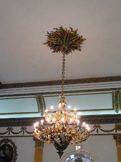
I enjoyed looking at the ornate fixtures and the artwork. Everything is so grand and large.
Wednesday, April 29, 2009
Airplane Ride
Today, Dena told me she was taking me on a special trip. She said it was going to be long and that we would be riding in an airplane, Like cars, airplanes have seat belts and for safety, I had to buckle up for take-off.
It was so exciting! I got to sit in a window seat. Before we left the airport, I saw some other airplanes parked next to us. Can you guess where we were going?
IRELAND!
Ireland is the third-largest island in Europe, and the twentieth-largest island in the world. It lies to the north-west of continental Europe and is surrounded by hundreds of islands and islets. To the east of Ireland, separated by the Irish Sea, is the island of Great Britain.
Trying to figure out the time zones was a little confusing. Washington state is 8 hours behind Ireland. We had been traveling for twelve hours. In Washington it was 4 in the morning and in Dublin it was 11AM. I actually watched the sunrise from the airplane window.
I soon found out we were going to be landing in Dublin.
Dublin airport opened in 1940. It has only 2 runways, but serviced 23.5 million passengers in 2008. It’s a busy place! We went through customs and got our passports stamped and then it was off to catch a bus to the hotel. As you can see, the buses have two levels and they drive on the left side of the road!
We were very tired when we arrived at the hotel, so we decided to get some sleep. I can't wait to see what tomorrow brings!
Subscribe to:
Posts (Atom)