We are staying at the Regency Hotel in Whitehall. Whitehall is on the northern outskirts of Dublin's inner city between Dublin and the airport. Dublin is both the largest city and capital of Ireland. It is located near the midpoint of Ireland's east coast, at the mouth of the River Liffey and at the center of the Dublin Region. Founded as a Viking settlement, the city has been Ireland's primary city for most of the island's history since medieval times. Today, it is ranked 10th in the Global Financial Centres Index and has one of the fastest growing populations of any European capital city.
After a nice continental breakfast, we caught the bus to Dublin. The hotel is conveniently located right next to a bus stop and it only takes 10 minutes to get to the city center. We walked from the bus drop off to the Chester Beatty Library.
The Chester Beatty Library is a public charitable trust established under the will of the late Sir Alfred Chester Beatty, which was granted probate in 1969. The role of the Library is to protect, preserve and make available to the public in the form of exhibitions, popular publications, lectures and other events the heritage enshrined in the collections of the late Chester Beatty.
Next door to the Chest Beatty Library is Dublin Castle. Dublin Castle was first founded as a major defensive complex upon the orders of King John of England in 1204, shortly after the Norman invasion of Ireland in 1169, when it was commanded that a castle be built with strong walls and good ditches for the defense of the city, the administration of justice, and the protection of the King’s treasure. Largely complete by 1230, the castle was of typical Norman courtyard design, with a central square devoid of a keep, bounded on all sides by tall defensive walls and protected at each corner by a circular tower. The building survived until 1673 when it was damaged by fire and demolished shortly afterwards. No trace of medieval buildings remain above ground level today, with the exception of the great Record Tower. It is the sole surviving tower of the original fortification, its battlements an early 19th-century addition.
The castle is a tourist attraction and, following major refurbishment, is also used as a conference center. During Ireland's presidencies of the European Union, including most recently in the first half of 2004, it has been the venue of many meetings of the European Council. The crypt of the Chapel Royal is now used as an arts center, and occasional concerts are held in the grounds of the Castle. The complex of buildings is usually open to the public, except during state functions.
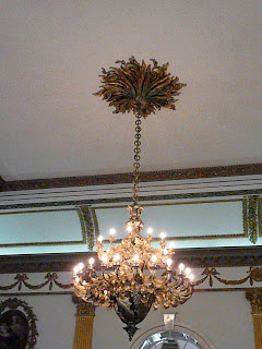
I enjoyed looking at the ornate fixtures and the artwork. Everything is so grand and large.
Thursday, April 30, 2009
Wednesday, April 29, 2009
Airplane Ride
Today, Dena told me she was taking me on a special trip. She said it was going to be long and that we would be riding in an airplane, Like cars, airplanes have seat belts and for safety, I had to buckle up for take-off.
It was so exciting! I got to sit in a window seat. Before we left the airport, I saw some other airplanes parked next to us. Can you guess where we were going?
IRELAND!
Ireland is the third-largest island in Europe, and the twentieth-largest island in the world. It lies to the north-west of continental Europe and is surrounded by hundreds of islands and islets. To the east of Ireland, separated by the Irish Sea, is the island of Great Britain.
Trying to figure out the time zones was a little confusing. Washington state is 8 hours behind Ireland. We had been traveling for twelve hours. In Washington it was 4 in the morning and in Dublin it was 11AM. I actually watched the sunrise from the airplane window.
I soon found out we were going to be landing in Dublin.
Dublin airport opened in 1940. It has only 2 runways, but serviced 23.5 million passengers in 2008. It’s a busy place! We went through customs and got our passports stamped and then it was off to catch a bus to the hotel. As you can see, the buses have two levels and they drive on the left side of the road!
We were very tired when we arrived at the hotel, so we decided to get some sleep. I can't wait to see what tomorrow brings!
Saturday, April 25, 2009
Brrr!
Today I went to Mount Baker.
Mount Baker is 10,778 feet, making it the fourth-highest mountain in Washington State. It is visible from much of Greater Victoria, Greater Vancouver and south to Seattle in Washington. It is also one of the snowiest places in the world; in 1999, Mount Baker Ski Area set the world record for snowfall in a single season—1,140 inches.
Mount Baker is also an active glaciated andesitic stratovolcano in the North Cascades of Washington State. It is the second-most active volcano in the range after Mount Saint Helens. It last erupted in 1880.
It still has alot of snow on it and will continue to have a good amount of snow at the top throughout the summer. It was cold. Brrrr!
I even tried jumping into the ski lift, but it was closed for the season. It’s probably a good thing, because I don’t think I know how to ski.
On the way up we stopped at a park near at the base of the mountain. There was a HUGE douglas fir log. Did you know you can tell a tree's age by the number of rings it has? Each ring counts as one year. It was so big, I lost count.
Further up the mountain we stopped at Nooksack Falls. The Nooksack River was used for hydroelectric power from 1906 to 1997. There's a lot of water running through there and it's loud!
The area is beautiful. The trees are SOOOOO tall. The view at the summit was spectacular. I won't soon forget it.
Friday, April 24, 2009
A trip to Starbucks
After preschool Miss Jana took me to Starbucks and I met her daughter Amanda. She is really nice and bought me a hot chocolate!
The original Starbucks was opened in Pike Place Market in Seattle, Washington, in 1971 by three partners: English teacher Jerry Baldwin, history teacher Zev Siegel, and writer Gordon Bowker. They opened their first store to sell high-quality coffee beans and equipment. Now, Starbucks is the largest coffeehouse company in the world, with 16,120 stores in 49 countries.
They don't make a bad cup of coffee either!
More information: http://www.starbucks.com/
Preschool Friends
I met some new friends today at Saint Paul's Preschool.
Miss Jana is a friend of Dena and Molly's and she asked if she could take me to school and introduce me to her students.
It was so much fun! Today they went on a nature walk and I got to eat lunch with them.
They even allowed me to change the calendar today.
Oh, the BEST part was they read my story! Can you believe it? They really made me feel special.
Thursday, April 23, 2009
Playing foosball at work
I went to work with Molly today.
She is a drafter in an architect's office called Theisen Architects. Architects plan and design buildings and help supervise the construction of a building. Molly's office in an old telephone switching building. It even has a crooked window in the front!
I got to watch her work on her computer. She takes sketches and draws building plans on the computer. Her office has done plans for schools, houses and restaurants.
Molly's boss, Tom, is very nice and he likes to have fun. He even has a foosball table in the office! I tried to win a game agaist the designer Scott, but he was just too good for me. I'll have to get in some practice time.
Wednesday, April 22, 2009
Did you know?
There's an Underground Seattle?
Seattle's first buildings were wooden. In 1889, a cabinetmaker accidentally overturned and ignited a glue pot. An attempt to extinguish it with water spread the burning grease-based glue, and the Great Seattle Fire ended up destroying 33 city blocks.
Instead of rebuilding the city as it was before, city officials ordered that all rebuilding use stone or brick—insurance against a similar disaster in the future. They also decided to take advantage of the destruction to regrade the streets one to two stories higher than the original street grade. Pioneer Square had originally been built mostly on filled-in tidelands and as a consequence it often flooded.
To regrade, the streets were lined with concrete walls which formed narrow alleyways between the walls and the buildings on either side of the street, and a wide "alley" where the street was. The naturally steep hillsides were used, and through a series of sluices, material was washed into the wide "alleys", effectively raising the streets to the desired new level, generally twelve feet higher than before, though some places were nearly thirty feet.
At first, pedestrians climbed ladders to go between street level and the sidewalks in front of the building entrances. Brick archways were constructed next to the road surface, above the submerged sidewalks. Skylights with small panes of clear glass, (which later turned to amethyst-colored because of manganese in the glass), were installed, creating the area now called the Seattle Underground.
When they reconstructed their buildings, merchants and landlords knew that it would just be a matter of time before what was originally the ground floor would be underground, and what was originally the next floor up would be the new ground floor. As a result, there is very little decoration on the doors and windows of the original ground floor, but extensive decoration on the new ground floor.
Once the new sidewalks were complete, building owners moved their businesses to the new ground floor, although merchants carried on business in the lowest floors of buildings that survived the fire, and pedestrians continued to use the underground sidewalks lit by the glass cubes (still seen on some streets) embedded in the grade-level sidewalk above.
Today, people can take a tour of parts of the underground city.
More information: http://en.wikipedia.org/wiki/Seattle_Underground_Tour
Tuesday, April 21, 2009
A new friend!
"Pam is thrilled she was finally able to meet Flat Stanley at rehearsal at McIntyre Hall!" -Pam
I had the pleasure of meeting Pam Rolfson at a Skagit Valley Chorale rehearsal tonight. The Chorale is preparing for their spring concert coming up this weekend. Pam sings first alto in the Chorale and is a friend of Dena and Molly's. She is REALLY nice and her glasses are SOOOO cool! She was so excited to meet me when she heard I was in town, she ordered the box set of all my books!
It was nice to meet you Pam!
Monday, April 20, 2009
Did you know?
There’s a troll in Seattle?
The Fremont Troll (also known as The Troll, or the Troll Under the Bridge) is a piece of whimsical public art in the Fremont neighborhood of Seattle.
The idea of a troll living under a bridge is derived from the Scandinavian folk tale "Three Billy Goats Gruff."
The Troll is a mixed media megalithic statue, located on N. 36th Street at Troll Avenue N., under the north end of the Aurora Bridge. Aurora Avenue North was renamed "Troll Avenue" in its honor in 2005. Despite its name, the Troll is not under the nearby Fremont Bridge. It is clutching an actual Volkswagen Beetle, as if it had just swiped it from the roadway above.
The piece was the winner of a competition sponsored by the Fremont Arts Council in 1990, and was built the same year. The Troll was sculpted by four local artists: Steve Badanes, Will Martin, Donna Walter, and Ross Whitehead. The Troll is 5.5 m high, weighs two tons, and is made of steel rebar, wire, and concrete.
More information: http://en.wikipedia.org/wiki/Fremont_Troll
Sunday, April 19, 2009
Today I became an international traveller!
Dena took me to another country today! We drove North to the Peace Arch and I was in Canada!
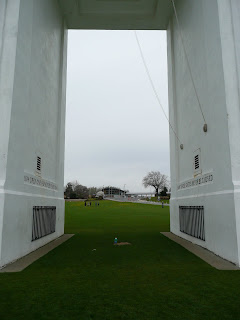
The Peace Arch is a monument situated on the Canada – United States border between the communities of Blaine, Washington and Surrey, British Columbia. The Peace Arch, which stands 67.2 ft tall, was built by Sam Hill and dedicated in September 1921, and commemorates the signing of the Treaty of Ghent in 1814. The monument is built on the exact United States – Canada boundary, between Interstate 5 and Highway 99, in the grass median between the northbound and southbound lanes. The Peace Arch has the flags of the U.S. and Canada mounted on its crown, and two inscriptions on both sides of its frieze. The inscription on the U.S. side of the Peace Arch reads "Children of a common mother", and the words on the Canadian side read "Brethren dwelling together in unity". Within the arch, each side has an iron gate hinged on either side of the border with an inscription above reading "May these gates never be closed".
Here I am standing right on the border looking towards the United States. Canada is behind me. As you can see, the Peace arch is HUGE!
As we were leaving the park, I saw a really cool sculpture of a sea horse. It's scales are made of horseshoes!
Saturday, April 18, 2009
Seattle!
I went to Seattle today! It's HUGE! The buildings reach up to the sky. So many people, so many cars, so much activity! There is a hustle and bustle here that I haven't experienced.
Seattle is the most populous city in the state of Washington. A coastal city and major seaport, it is located in the western part of the state on an isthmus between Puget Sound and Lake Washington, and is about 96 miles south of the Canada – United States border. By the 2007 Census estimate, the city has a municipal population of 594,210, making it the twenty-fourth largest city by population in the United States. Seattle's current official nickname is the "Emerald City", the reference is to the lush evergreen trees in the surrounding area.
We started at the Space Needle. The Space Needle is a major landmark of the Pacific Northwest and a symbol of Seattle. Located at the Seattle Center, it was built for the 1962 World's Fair, during which time nearly 20,000 people a day used the elevators. The Space Needle is 605 feet high at its highest point and 138 feet wide at its widest point and weighs 9,550 tons. When it was completed it was the tallest structure west of the Mississippi River. It is built to withstand winds of up to 200 mph. There is an observation deck and a restaurant at the top. The restaurant rotates. You can see the entire city up there! It's so tall!
After the Space Needle, we went to Pike Place Market. Pike Place Market is a public market overlooking the Elliott Bay waterfront. The Market opened August 17, 1907, and is one of the oldest continually operated public farmers' markets in the United States. It is a place of business for many small farmers, craftspeople and merchants. Named after the central street, Pike Place runs northwest from Pike Street to Virginia Street, and remains one of Seattle's most popular tourist destinations.
It was fun and there were many people! We bought fresh flowers and watched the fishmongers throw fish across the market. People were selling all sorts of handcrafted items, honey, preserves and fresh fruit & vegetables. There were so many smells, and the sounds: a man was playing a violin and it echoed up into the market, people were chattering, birds were singing, cars were driving by! It was an exciting day!
Oh, and I was able to clear up one misconception: There isn't a Starbuck's on EVERY corner in Seattle, but there sure are a lot of coffee shops. They really take their coffee seriously up here!
Thursday, April 16, 2009
Did you know?
Washington has a volcano!
Mount St. Helens is an active stratovolcano located in Skamania County, Washington, in the Pacific Northwest region of the United States. It is 96 miles south of Seattle and 53 miles northeast of Portland, Oregon. Mount St. Helens takes its English name from the British diplomat Lord St Helens, a friend of explorer George Vancouver who made a survey of the area in the late 18th century. The volcano is located in the Cascade Range and is part of the Cascade Volcanic Arc, a segment of the Pacific Ring of Fire that includes over 160 active volcanoes.
Mount St. Helens is most famous for its eruption on May 18, 1980, at 8:32am PDT which was the deadliest and most economically destructive volcanic event in the history of the United States. Fifty-seven people were killed; 250 homes, 47 bridges, 15 miles of railways, and 185 miles of highway were destroyed. The eruption caused a massive debris avalanche, reducing the elevation of the mountain's summit from 9,677 feet to 8,365 feet and replacing it with a 1 mile wide horseshoe-shaped crater. The debris avalanche was up to 0.7 cubic miles in volume. The Mount St. Helens National Volcanic Monument was created to preserve the volcano and allow for its aftermath to be scientifically studied.
More information: http://en.wikipedia.org/wiki/Mount_St._Helens
Wednesday, April 15, 2009
Boeing
Dena took me to work with her today at Boeing.
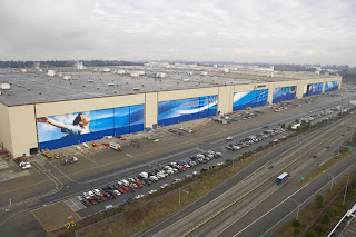
The Boeing Company is a major aerospace and defense corporation, originally founded in 1916 by William E. Boeing in Seattle, Washington. The Boeing plant is the largest building by volume in the world. In fact, it is so big you can see it in space. During World War II they built a temporary neighborhood on the plant to disguise the building from enemy planes that might fly overhead.
Dena works on the 747 airplane. The 747 is the largest airplane in the Boeing fleet. They just started construction on the newest 747 model.
Here I am next to the wheel of the last manufactured 747-400. Production has already begun on the new model, 747-8.
The Boeing plant is HUGE and there is so much activity going on there. It's so exciting!
Here are some interesting facts about the 747:
- The 747-400 wing measures 5,600 square feet, an area large enough to hold 45 medium-sized automobiles.
- The 747 fleet has logged more than 42 billion nautical miles, equivalent to 101,500 trips from the Earth to the moon and back.
- The 747 fleet has flown 3.5 billion people - the equivalent of more than half of the world's population.
Subscribe to:
Posts (Atom)